At the Inter-American Development Bank’s Cities Lab, we believe that the path to more equitable, livable cities depends on our ability to recognize what has long remained unseen.
Informal settlements – home to more than one in four urban dwellers worldwide – continue to be underrepresented in official maps, data systems, and development agendas. This invisibility limits planning, hinders investment, and perpetuates cycles of vulnerability. But what if we could change that using the power of artificial intelligence, satellite imagery, and collaborative action?
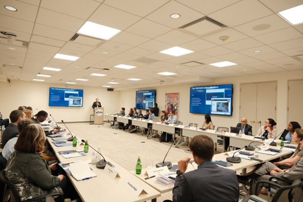
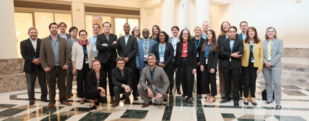
That’s exactly what brought worldwide experts, practitioners, and innovators to our headquarters in Washington, D.C. for the AI Mapping for Urban Poverty Alleviation Symposium, held on April 29–30, 2025. Together with partners from the World Bank, UN-Habitat, the African and Asian Development Banks, CIESIN, Humanitarian OpenStreetMap Team, UNITAC, major tech players like Google, Microsoft, Meta, and ESRI -alongside many other collaborators- we launched a shared effort to close the data gaps that leave too many communities behind.
You can explore more of our work at IDB Cities Lab.
Why AI Mapping – And Why Now?
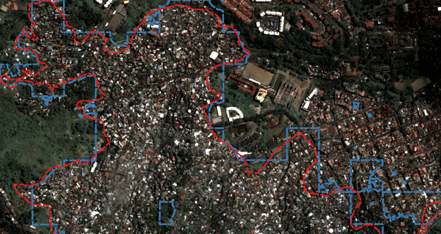
Across Latin America and the Caribbean (LAC), more than 80% of the population lives in urban areas. Many of our cities are growing rapidly, often in ways that stretch infrastructure, increase exposure to climate risk, and leave some residents without access to basic services. Around 21% of urban residents in LAC live in informal settlements, spaces not always reflected in official data.
Without reliable, up-to-date maps, local governments are left navigating blind. They struggle to deliver sanitation, healthcare, education, and resilience planning where it’s most needed. At the same time, growing data resources, like AI-powered analysis of satellite imagery and community-generated datasets, are more accessible than ever.
But we’re still missing the connection: a shared framework to coordinate, scale, and ethically deploy these tools.
Two Days of Big Ideas and Shared Commitments
The Symposium opened with powerful calls to action from IDB leaders. Juan Pablo Bonilla, ( Manager of the, Climate Change and Sustainable Development Sector,) emphasized the opportunity for innovation to drive systemic transformation. Tatiana Gallego Lizón, ( Chief of the, Housing and Urban Development Division,) urged greater alignment and standardization to reduce fragmentation across sectors. Cities Lab’s own Washington Fajardo reminded us that the motto “Reveal. Respond. Remediate.” speaks to a historic opportunity to bring underserved communities into the light -and into the center of policymaking.
Over the course of two days, participants tackled the following key questions:
- What global standards can we co-develop for mapping urban deprivation using AI?
- How do we ensure data is locally owned, actionable, and responsibly used?
- What partnerships and platforms can help scale this work globally?
From Columbia University’s CIESIN to the European Space Agency, and from local data stewards to technology experts, speakers and attendees alike offered real-world case studies and future-forward ideas.
What We Learned (And Where We’re Going)
Participants were clear: the time is now to build a global urban data ecosystem that integrates local knowledge, high-resolution imagery, and open tools to support inclusive urban development. Key takeaways included:
- Local ownership is essential. Mapping efforts must be co-designed with the people and institutions who will use the data.
- Shared infrastructure is needed. A multi-stakeholder platform -open to governments, NGOs, academia, and tech firms- could house models, data, and documentation.
- Practical use cases matter. Whether it’s guiding infrastructure investments or identifying communities most at risk from climate impacts, AI mapping must support decision-making on the ground.
- Ethics and equity are non-negotiable. Responsible AI use and open standards are necessary to avoid digital divides and data misuse.
The final sessions laid the groundwork for a global coalition dedicated to urban poverty mapping. Priorities include drafting a joint vision statement, producing a position paper on AI and urban deprivation, and hosting a special session at the next World Urban Forum.
What Comes Next?
We don’t just want to map poverty. We want to transform the way cities understand and respond to it. This initiative’s first major deliverable may be a field-tested methodology -combining AI, satellite imagery, and ground truthing- to support city-level mapping of deprivation. In the longer term, we aim to co-create a standardized, global dataset on urban poverty. The Symposium’s participants agreed: this is not just a technical challenge. It’s a matter of justice, inclusion, and smarter governance.
Crucially, upcoming urban informality mapping projects supported by the IDB’s Housing and Urban Development Division are already being shaped by the lessons of this Symposium. These efforts are being designed using open software and shared methodologies to ensure they can inform future initiatives in any region.
We invite governments, researchers, communities, and technologists around the world to join us. Together, we can reveal a more accurate picture of where urban poverty exists, respond with informed action, and remediate its root causes.
Stay connected with us and follow the Cities Lab’s initiatives here.
Leave a Reply