City planners often lack updated digital maps of existing buildings and structures. The Building Detection Model can automatically generate a basic map of buildings from satellite images. It uses semantic segmentation, which is the process of assigning each pixel in an image into a category; in this case, the categories are ‘building’ or ‘not building’. This allows planners to … [Read more...] about Urban machine learning model: automatic classification of buildings and structures
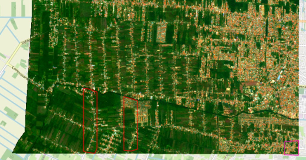
Open code: urban growth prediction by analyzing satellite images

While urban growth prediction models are not new, they have historically required significant resources in time, expertise, and calculations. That’s why we have developed this open code of urban growth prediction. The model automates this process, allowing urban planners to spatially extrapolate the growth of their city under different scenarios (e.g., future population size, … [Read more...] about Open code: urban growth prediction by analyzing satellite images
OpenStreetMap Extraction tool: generating neighborhood-level maps
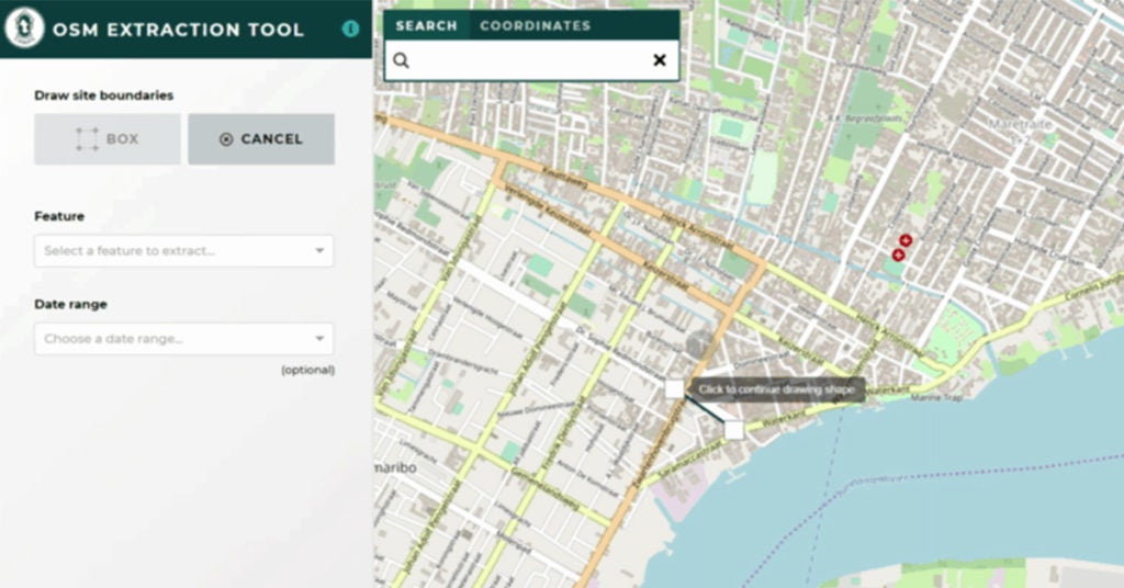
Considering the digital revolution, Latin American and Caribbean cities should be poised to generate, analyze, and disseminate urban data. Yet, all too often, our partners do not have the tools necessary for delivering urban services to informal areas, identifying and allocating lands best suited for development while protecting at-risk areas, and working with individual … [Read more...] about OpenStreetMap Extraction tool: generating neighborhood-level maps
OpenMapKit: create and systematize surveys in the field

Paper records are still quite common for field data collection in many housing agencies, where the infrastructure required to create, implement, manage and maintain survey data often includes paywalls or high levels of technical expertise. OpenMapKit solves one of the most immediate needs for government agencies to collect and manage data from the field, incorporating automatic … [Read more...] about OpenMapKit: create and systematize surveys in the field
DATUM: facilitating community collection and public use of urban mobility data in the Americas
In cities throughout Latin America and the Caribbean (LAC), public transport serves an essential role, connecting people with employment, commerce, leisure, and each other. However, public transport networks in LAC cities, both formal and informal, can lack detailed information about routes and schedules, leaving users to rely on word of mouth to know what routes can take them … [Read more...] about DATUM: facilitating community collection and public use of urban mobility data in the Americas