While urban growth prediction models are not new, they have historically required significant resources in time, expertise, and calculations. That’s why we have developed this open code of urban growth prediction. The model automates this process, allowing urban planners to spatially extrapolate the growth of their city under different scenarios (e.g., future population size, different time horizons, sensitivity to restricted areas, degree of randomness, etc.), based on past growth and current land use.
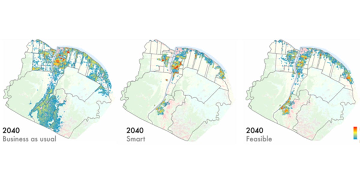
This urban growth prediction model uses maps of the physical and social characteristics of an urban area to predict the growth of urbanistic characteristics in future years. Growth attractors (such as transport, quality of life, topography and services) and limiters (such as bodies of water or protected areas) selected by the modeler according to the conditions of the urban area in question are used to determine if a pixel in the map image will exhibit urbanized features or not at the end of a designated period of time. The predictions can be used to plan optimized urban expansion and estimate the best and worst scenarios of climate change.
As inputs, the model uses monochrome images with standardized size and boundaries prepared from satellite images of an urban area. These images can be physical maps, density maps, or maps denoting legislative or social boundaries, depending on the conditions of the urban area and the modeler’s discretion. Attraction features will include, for instance, proximity to transit stations, and will be assigned a positive weight; restrictor features will include conditions such as flood-risk or conservation lands and will be assigned a negative weight.
The model allows for the visualization of different growth scenarios, depending on the calibrations and inputs. Each image should only contain information about a single characteristic, since each one will be assigned a positive or negative weight. Using these inputs, a regularized spatial logistic regression model predicts future urban growth on a pixel-by-pixel level within the determined boundaries, and outputs a binary raster file showing growth.
This tool is part of our Open Urban Planning Toolbox, a set of open-source tools to support each step of the urban development planning process, from early design through implementation and evaluation of projects. Open-source software is made stronger by the community that contributes to it. We welcome users to apply the tools in their own cities, share ideas for improvement, and help identify areas of need that could be addressed with new open-source tools.
Download now this open code! Urban Growth Prediction: predict urban growth on maps.
Thanks
Merci pour l’article