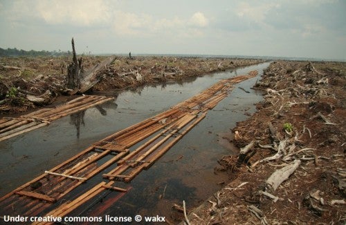
The Food and Agricultural Organization of the United Nations (FAO), in its latest State of the World Forests estimates that the rate of deforestation remains “alarmingly high.” In some regions such as Latin America or Africa it averaged 0.5% per year over the last decade. Latin America contains over half (57%) of the world’s primary forests.
In the last twenty years, Africa has lost close to 75 million hectares of forest area which is very close to the land area in Texas, the second largest state in the U.S., or Spain and Italy combined.
Deforestation and degradation in developing countries is a leading cause of climate change. Tropical deforestation accounts for a fifth to a quarter of total emissions of greenhouse gases. So it is clear that given the limited resources available to tackle forest conservation, interventions should be effective and efficient and their evaluation rigorous.
Up to a few years ago, rigorous evaluations were sparse in good part because of their cost, relying on expensive field measurements. The emergence of high resolution remote sensing (mostly satellite) data and imagery along with the increase in GIS capacity to analyze this data, have dramatically reduced these costs.
Now that costs are down, it comes very handy to have a practical guide in how to leverage this data into rigorous evaluations that inform policy and decision making in this critical area. This paper, which is a part of our Impact Evaluation Guidelines series, by Allen Blackman from Resources from the Future, provides a non technical introduction and practical guide to rigorous ex-post evaluation of forest conservation policies using remotely sensed data.
It is informative, practical and rigorous….
The paper provides a comprehensive review of:
(i) The empirical approach to using remotely sensed data for evaluating conservation efforts, including its defining characteristics and associated terminology
(ii) The relevant literature
(iii) The data typically used to analyze forest conservation including outcome, treatment and control variables, and a complete set of data sources
(iv) The main challenges in evaluating forest conservation including estimating credible counterfactuals
(v) The empirical quasi-experimental strategies (matching and regression) that can be used in these evaluations, paying attention to those aspects that are more relevant to the evaluation of forest conservation policy
(vi) The modeling choices that need to be made including data assembly, , the unit of analysis, sampling, study area definitions, measuring and correcting for spillovers, and the empirical strategies that are more appropriate
The paper also provides two very interesting examples of recently published ex-post analysis of forest conservation of protected areas in Costa Rica and Thailand.
The Costa Rica example uses matching techniques to conclude that “protection reduced deforestation: approximately 10% of the protected forests would have been deforested had they not been protected.
Conventional approaches to evaluating conservation impact, which fail to control for observable covariates correlated with both protection and deforestation, substantially overestimate avoided deforestation (by more than 65%, based on our estimates).
We also find that deforestation spillovers from protected to unprotected forests are negligible.” The Thai example uses a regression approach and concludes that protected areas have a significant effect on deforestation on northern Thailand, with the treatment effect ranging from 7 to 19 percentage points.
There is clearly a significant scope of further applications of this approach to evaluating conservation policies.


Leave a Reply